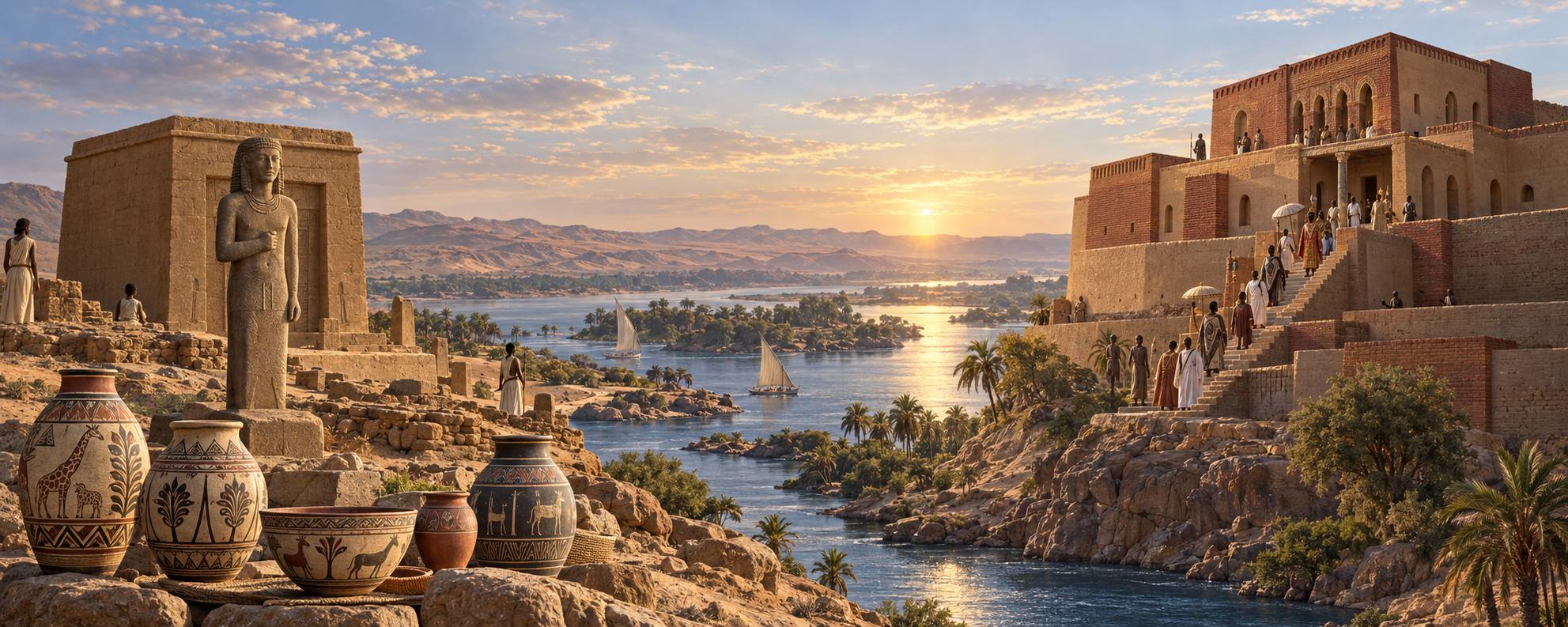
Conceptual illustration generated with OpenAI for Kandaka, 2026. It juxtaposes Meroitic Karanog and medieval Old Dongola; the sites did not share this landscape or moment. Architecture and ceremonial details are imaginative, not an archaeological reconstruction.
One monument lies beneath a reservoir. The other survives as a building whose name still carries a question.
Karanog was a Kushite settlement in Lower Nubia, on the west bank of the Nile near Aniba and Qasr Ibrim, in what is now southern Egypt. Its cemetery yielded nearly eight hundred excavated graves, Meroitic inscriptions, painted pottery, carved stone figures, textiles, glass, bronze and woodwork. The landscape was later submerged by the reservoir created by the Aswan High Dam.1
Farther south, in Sudan, the building traditionally known as Dongola’s Throne Hall preserves a different kind of record. Usually dated to the ninth century, it has been interpreted as a royal audience hall for Makuria’s kings, although a church remains an alternative. A foundation inscription documents its establishment as a mosque in 1317; published research records the end of mosque use in 1969.2
These places belong to different historical worlds. Yet reading them together helps move Nubian history away from the margins of somebody else’s story. Their objects and architecture invite us to ask how communities selected what travelled, changed its meaning and made it serve local institutions. The evidence does not require an unbroken identity between Meroitic Karanog and medieval Dongola. It asks us to take each society seriously on its own terms.
Karanog Was Not a Roman Cemetery
The original excavation report, published in 1910 by C. Leonard Woolley and David Randall-MacIver, was titled Karanòg: The Romano-Nubian Cemetery. Its authors explained “Romano-Nubian” as a deliberately noncommittal label for the region during Roman rule in Egypt. The title does not establish that Karanog was a Roman colony.3
The cemetery belonged to the northern world of Meroitic Kush. Meroitic inscriptions, local burial practices and distinctive pottery sit alongside objects connected with Egypt and the Roman Mediterranean. Those connections matter, but an imported object does not explain the whole society that used it. Nor does a stylistic resemblance, by itself, establish an object’s precise place of manufacture or route to the grave.4
The excavation report also identified Karanog’s people as Blemmyes through arguments drawn from classical accounts and racial classifications of bodies and faces. These are not established ethnic facts. The report remains indispensable as a record of finds, but its racial hierarchies must be separated from what the excavators observed. Its contradictions are revealing: the same authors who imposed those hierarchies also recognized Nubian adaptation and praised the originality of the painted pottery.3
Chronology requires similar care. The 1910 report proposed a date range within the Common Era, giving particular weight to the third century and extending into the fifth. Its concluding estimate placed the beginning roughly a century after the start of the era. Later scholarship revised that framework. Williams’s regional comparisons emphasize important second- and third-century material, while Török traces Karanog’s cemetery development back into the early first century BCE. These arguments use different evidence and retain uncertainties. The later rich graves should not stand for the whole cemetery’s history.5
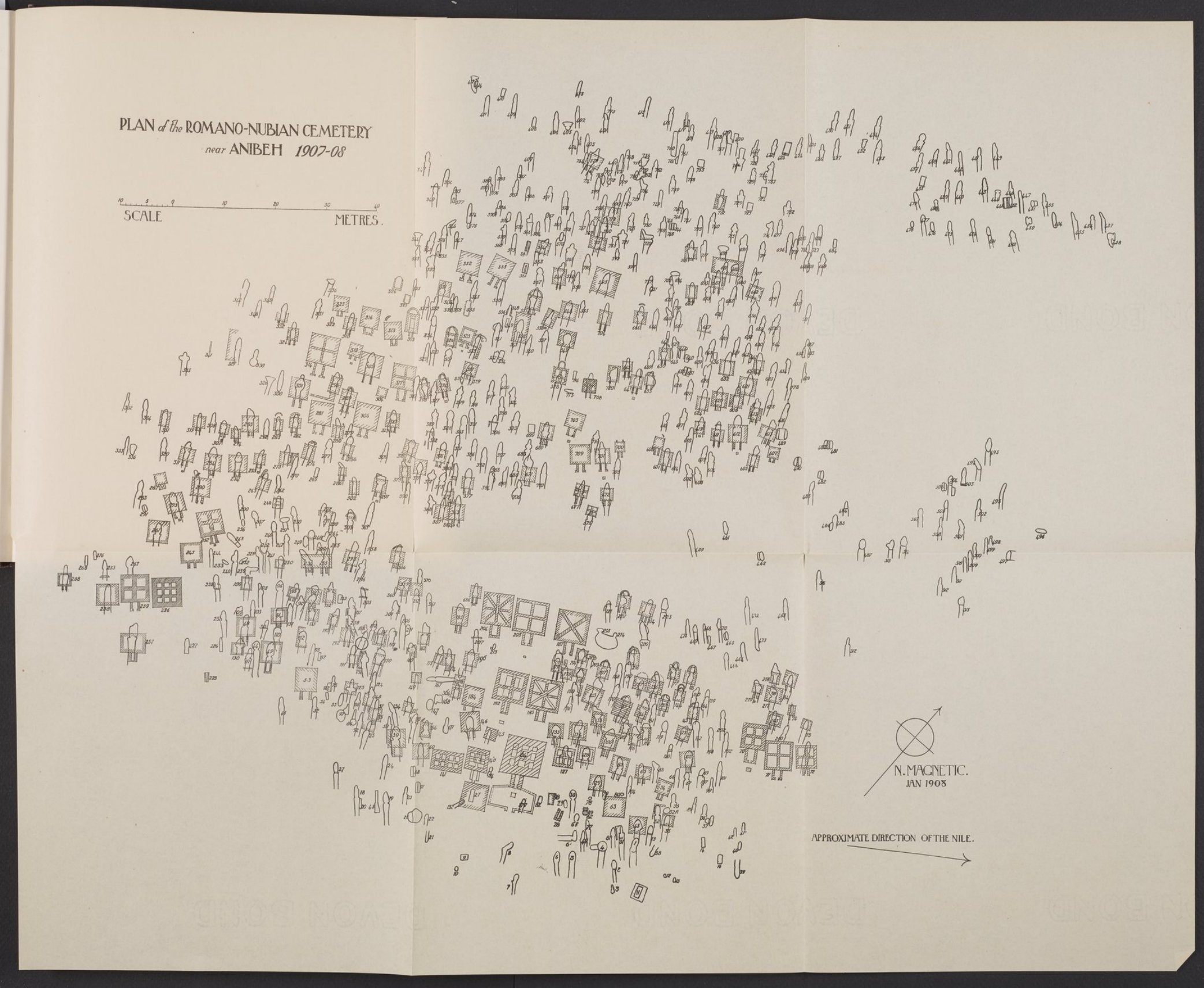
Excavation plan of the cemetery near Anibeh, surveyed in 1907–08. Woolley and Randall-MacIver, Karanòg (1910), pl. 116. Scan hosted by NYU Institute of Fine Arts. Source.
The University of Pennsylvania’s Eckley B. Coxe Junior Expedition excavated the cemetery in 1907–08. Trial work at the town followed in January 1909, with the main settlement campaign in winter 1909–10. The cemetery lay just north of Aniba, several kilometres south of the town.6
The excavators reported nearly eight hundred graves, with one to eleven bodies in a grave. They estimated 3,000–4,000 interments, but their separately counted total was 1,124. The larger number is an estimate, not a population census; even the counted total belongs to the methods and classifications of the original excavation.7
Above ground, preserved superstructures varied in size. Many were built of mud brick, sometimes on sandstone foundations; the report records their absence from most graves. Offering tables, approaches and underground chambers made a varied funerary landscape. Reuse and disturbance complicate its interpretation, while the richest tombs cannot represent everyone buried there.8
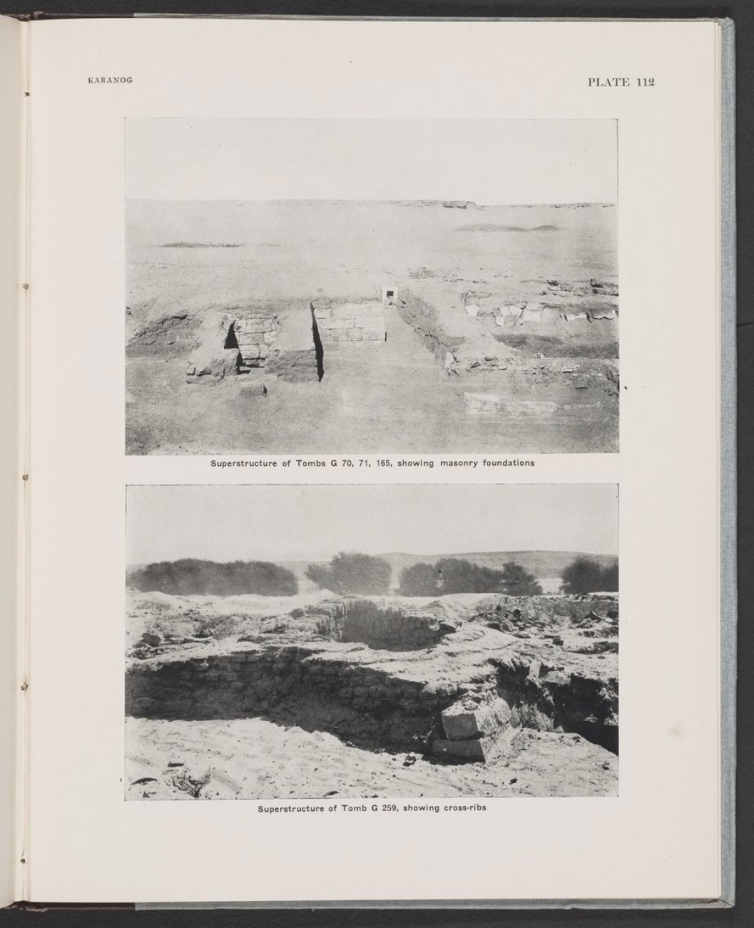
Tomb superstructures at Karanog: foundations of G70, G71 and G165 above; cross-ribs of G259 below. Woolley and Randall-MacIver, Karanòg (1910), pl. 112. Scan hosted by NYU Institute of Fine Arts. Source.
The Dead Were Remembered in Public
Among Karanog’s most distinctive finds are the sandstone figures conventionally called ba statues. The name links them to Egyptian ideas of existence after death, but their Meroitic forms and attributes deserve attention in their own right. Clothing, jewellery, wings and objects held in the hands offered ways of presenting the deceased. Their precise meanings and original settings are not always recoverable: many sculptures were displaced before excavation.9
The figure illustrated in the report’s first colour plate is a useful example. The excavators called it “royal” and assigned it to G187, although it was recovered in a robber’s hole behind another grave. Later scholarship associates it with Maloton, also rendered Meleton, a high official known by the title peseto. It should not be presented as a securely identified king found intact inside his tomb.10
The plate is also a reconstruction. Surviving traces helped guide the colouring, but the excavators added the disc above the head, conjectured the top of the staff and supplied the right-hand baton. Looking at it means looking both at an ancient sculpture and at a twentieth-century attempt to complete it.10
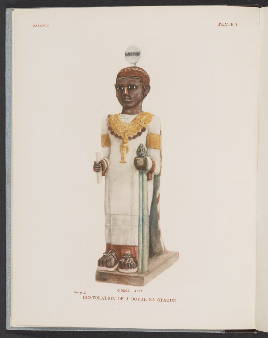
The excavators’ 1910 colour reconstruction of the figure attributed to G187, later associated with the official Maloton. The disc and hand-held attributes include conjectural additions. Woolley and Randall-MacIver, Karanòg, pl. 1; explanation, p. 47. Scan hosted by NYU Institute of Fine Arts. Source.
A cemetery can be read as an architecture of memory. The carved figure, offering table, inscribed stone and tomb approach created places where remembrance could take material form. The excavators recorded offering vessels in approaches, while carved loaves and libation vessels appear on stone tables. Penn Museum’s offering table E7089, from G153, combines this imagery with a Meroitic inscription. Its online catalogue lists its current location as Collections Storage, not a public gallery.11
The grave goods broaden the picture: painted vessels, glass and bronze, iron tools and weapons, beads, textiles, leatherwork and inlaid wooden caskets. Such objects offer evidence for ritual, resources, office and connections beyond the community. They do not provide a simple code in which every object identifies a gender, rank or family relationship.4
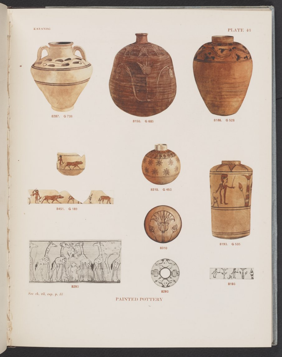
Painted vessels and decorative bands from Karanog, including giraffes and a hunter with a collared hound (8451, G189). Woolley and Randall-MacIver, Karanòg (1910), pl. 43; text p. 55. Scan hosted by NYU Institute of Fine Arts. Source.
The painted pottery makes local choices particularly visible. In plate 43, giraffes, plants and geometric bands share the page with human figures. One vessel shows a hunter and a large collared hound. The combinations invite us to see artisans composing images for their own settings, even when some forms had travelled from elsewhere.12
Writing offers another kind of presence. The Meroitic scripts have been deciphered, but the language remains incompletely understood. That distinction allows us to acknowledge both what scholars can read and what they cannot yet translate securely. The report’s plate of pottery marks also includes Greek and Demotic examples; some marks were inked or painted, others scratched.13
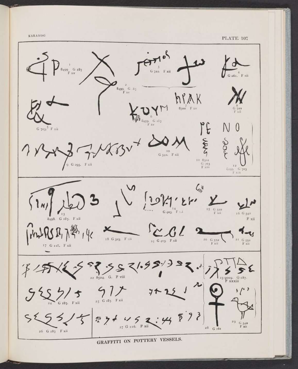
Pottery inscriptions and marks copied by the excavators, including Greek, Demotic and Meroitic examples, painted, inked or scratched on vessels. Woolley and Randall-MacIver, Karanòg (1910), pl. 107; text pp. 78–79. Scan hosted by NYU Institute of Fine Arts. Source.
What Was Lost When the Water Rose
The early excavation preserved plans, photographs, drawings and objects decades before the international High Dam salvage campaign. Yet preservation also involved removal. The 1910 report states that the Egyptian government retained a representative selection of pottery and bronzes, the G187 bowl and most inscribed stones. Much of the remaining material went to Philadelphia. That is a historical division of finds, not a present inventory of every object.14
The excavators also acknowledged that reaching burial chambers required the destruction of superstructures. Later inundation brought a different and much larger loss of landscape. Neither event should disappear behind a simple story in which excavation “saved” a site.14
The archive can therefore be read twice: first for what it records, and again for how it frames its subjects. A restored statue preserves traces and assumptions together. A plan records hundreds of graves while turning generations of mourning into numbered shapes. Old collections can still be restudied with better chronologies, scientific analysis and questions that take Meroitic society on its own terms. New research can reconnect objects to their contexts, but digital access does not settle every question about the authority of museums, researchers and source communities.
Dongola’s Building of Many Lives
Old Dongola, historically Tungul, was the capital of Makuria. Its emergence around the transition from the fifth to the sixth century and the kingdom’s sixth-century adoption of Christianity belong to a history of regional state formation and wider connections. Written culture in medieval Nubia used Old Nubian, Greek and Coptic, as well as Arabic. This was a connected society, not an isolated Christian outpost.15
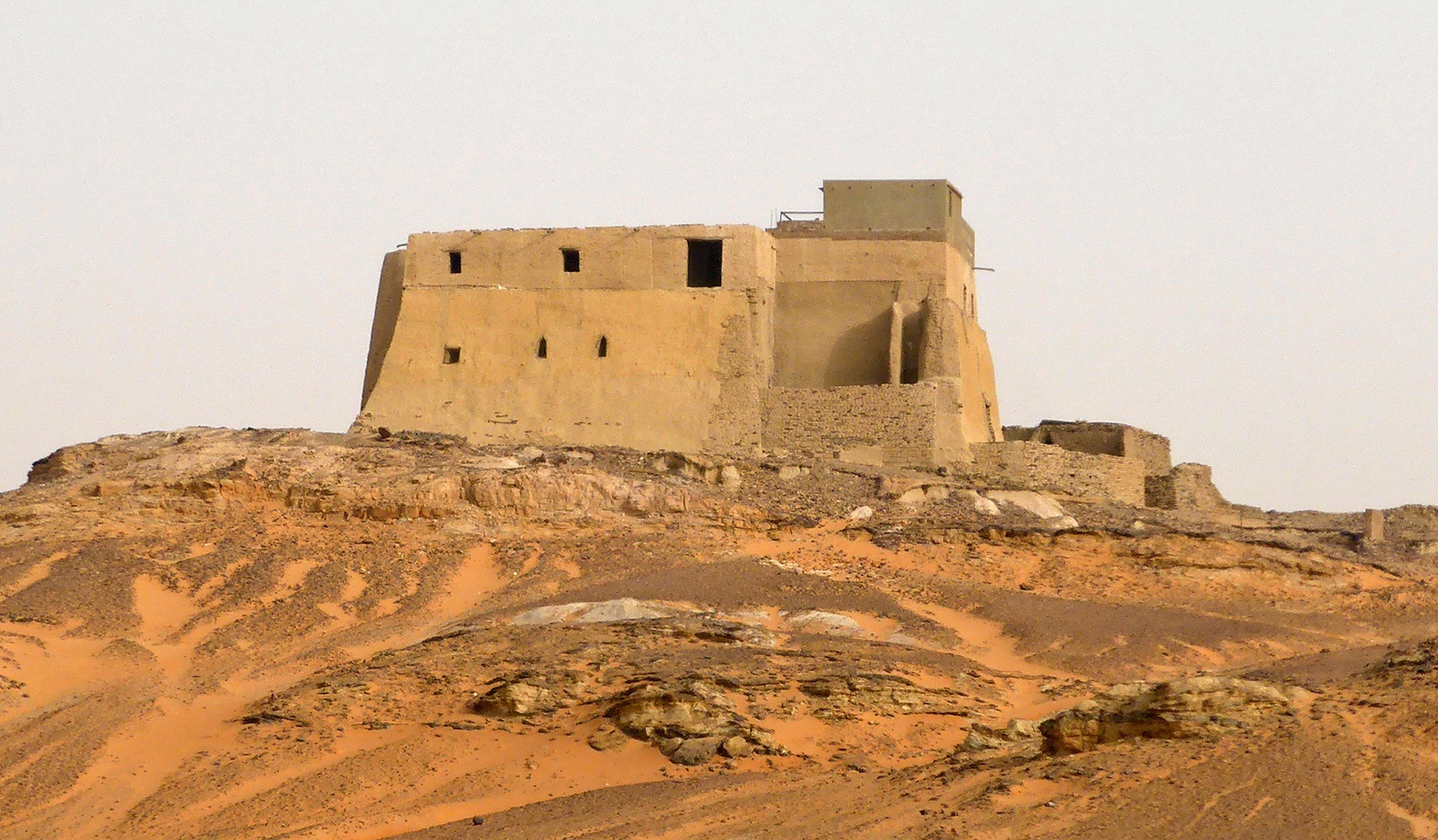
The building conventionally known as the Throne Hall or Mosque Building at Old Dongola. Photograph by LeGabrie, 18 March 2017, via Wikimedia Commons; CC BY-SA 4.0. Reproduced without edits by Kandaka. Source. CC BY-SA 4.0.

The Mosque Building measures approximately 28 metres by 18 metres and reaches about 12 metres in height in published descriptions. Mud brick, fired brick and sandstone form a substantial two-storey structure. Tall, narrow ground-floor rooms carried barrel vaults. A western staircase provided access to the upper floor, separately from the original lower-floor circulation.16
Godlewski and colleagues interpret the arrangement as suitable for official audiences. The upper central hall, about 7 by 6.9 metres, was surrounded by a corridor. Four granite columns and corresponding wall pilasters supported its timber ceiling; surviving beam fragments help inform the reconstruction of coffering. A raised central roof is more conjectural. The apse opened from the eastern corridor, rather than directly from the central hall.16
This architecture can suggest a carefully managed approach to authority: ascent, movement around an upper hall and entry into a commanding room. But that is an interpretation of use. Recent scholarship continues to describe the original building as a church or royal throne hall.2
Christian paintings survive in several phases. Warrior saints, archangel imagery and other fragments should not be assembled into a single, fully known ninth-century programme. In one north-wall composition, Christ occupies the centre of a cross whose arms carry the four apocalyptic beings. White-robed enthroned figures flank it, probably the elders of Revelation. Their complete number is not preserved. Another fragment retains a crown, but its wearer remains unidentified.17
If the room served royal audiences, such imagery could have placed earthly authority within a sacred order. Even with its function unresolved, the paintings show a Christian visual culture made and remade in a Nubian capital. They deserve to be read through their own architectural setting and successive phases.
1317 Was a Transformation, Not an Erasure
The Arabic foundation stela provides a firmer date than the building’s proposed original function. The Database of Medieval Nubian Texts catalogues it to 16 Rabīʿ I 717 AH, or 29 May 1317. The published historical reconstruction places the mosque’s establishment under Abdallah Barshambu, amid Mamluk intervention and dynastic struggle.18
The upper floor acquired a mihrab in its east wall and a minbar beside it. Christian paintings were covered with later plaster. Yet changed openings, roofs and surfaces belong to several episodes of rebuilding; not every visible alteration can be assigned to the moment recorded by the inscription.18
Nor did that moment end Christianity across Dongola. The archaeological guide describes churches continuing after the conversion and dates the court’s departure northward to 1364, with Dongola remaining the centre of a smaller kingdom. That precise year belongs to Godlewski’s historical reconstruction. The broader point is that political and religious changes unfolded over time, rather than arriving everywhere together.19
The building’s mosque history extended for more than six centuries: the published chronology records the end of use in 1969. Repairs and alterations changed its earlier form, while some Christian painting survived beneath later coverings. This was neither untouched survival nor simple erasure.20
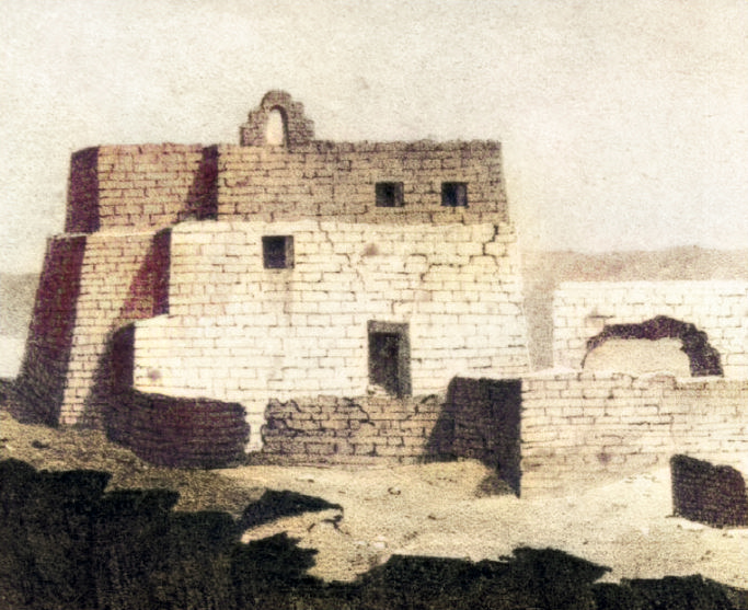
Old Dongola’s Mosque Building in Frédéric Cailliaud’s view of 1821, published in 1826, plate I. This digital version was colourised by LeGabrie using DeepAI in 2020; the colours are modern. Wikimedia Commons labels the file public domain. Source.

Calling it only the “Throne Hall” can obscure its long Muslim history. Calling it only a mosque can leave its earlier Christian fabric and disputed original function out of view. The double name preserves a question as well as a biography.
Two Monuments Against the Margins
Karanog and Dongola should not be collapsed into unbroken sameness. The phases compared here are many centuries apart, and their political institutions, languages and religious practices differ. Their connection is a question about cultural action: how did people select forms, give them local meaning and maintain or alter what they inherited?
At Karanog, Egyptian religious forms and Mediterranean objects entered Meroitic funerary settings. At Dongola, Christian architecture and imagery took shape within Makuria; later, Islamic worship occupied and changed an existing building. If the building originally served royal audiences, this would add a further episode to that history of adaptation.41618
Preservation raises the same question of agency in the present. Karanog’s landscape is submerged and its excavated material dispersed. Dongola’s surviving fabric requires continuing care. ALIPH lists the mosque conservation project as ongoing, while recent work by Habab Idriss and Mohamed Hassan Siedahmed documents Sudanese participation in heritage education and community programmes. Local stewardship is part of the monument’s history and present practice, not simply a recommendation from outside.21
The two monuments shift attention from the question “Who influenced Nubia?” to questions about the people making those choices. Who chose what to borrow? What did they change? Which institutions gave a foreign form a local meaning? Who maintained it, and who was later written out of its story?
Scans, catalogues and reconstructions can widen access. They cannot replace a landscape or exhaust the meanings people attach to it. Karanog’s cemetery and Dongola’s many-lived building were centres in their own worlds. Read in their different historical settings, they invite a history in which Nubian communities choose, interpret, build and remember.
Sources and notes. Page numbers below are printed pages. Where a link opens at a specific PDF page, that position refers to the linked digital edition. Online records were checked on 19 September 2026.
Further Reading — Kandaka Library
The Old Dongola archaeological guide is also available in Kandaka’s library. Its architectural descriptions should be read alongside the later scholarship cited above.
Woolley and Randall-MacIver, Karanòg: The Romano-Nubian Cemetery (1910), p. 3 and p. 81; Mann and van den Bercken, “Shokan. Revival of a forgotten village,” Sudan & Nubia 24 (2020), pp. 24–26. ↩︎
Godlewski, Dongola—Ancient Tungul (2013), pp. 43–47; Fushiya, “Heritage, tourism, and community,” PAM 34.2 (2025), p. 106; DBMNT Text 611. ↩︎ ↩︎
Woolley and Randall-MacIver (1910), pp. 3–5. The authors’ racial classifications are historical material for critique, not categories adopted here. ↩︎ ↩︎
Woolley and Randall-MacIver (1910), pp. 27–31, 46–48, 55, 69–74; Williams, Meroitic Remains from Qustul Cemetery Q, Ballana Cemetery B, and a Ballana Settlement (1991), pp. 17–20; Török, “Kinship and Decorum” (2002), pp. 67–69. ↩︎ ↩︎ ↩︎
Woolley and Randall-MacIver (1910), pp. 81–84; Williams (1991), pp. 17–20; Török (2002), p. 69. None is presented here as a definitive new absolute chronology for every grave. ↩︎
Woolley and Randall-MacIver (1910), preface vii–viii and p. 3; Woolley, Karanòg: The Town (1911), p. 1. ↩︎
Woolley and Randall-MacIver (1910), p. 81 and note. ↩︎
Woolley and Randall-MacIver (1910), pp. 46–48; Török (2002), pp. 67–68. ↩︎
Woolley and Randall-MacIver (1910), pp. 37–38 and 47; plate 1; Quertinmont, “La statuaire funéraire des dignitaires provinciaux de l’empire méroïtique” (2017), fig. 1 and note 7. The latter supplies the official’s identification, not proof of every reconstructed detail. ↩︎ ↩︎
Woolley and Randall-MacIver (1910), pp. 8–10; Penn Museum E7089, provenance, description and current-location fields. ↩︎
Woolley and Randall-MacIver (1910), p. 55, vessel 8451; plate 43. ↩︎
Rilly, “Meroitic,” UCLA Encyclopedia of Egyptology (2016), pp. 1–2; Woolley and Randall-MacIver (1910), pp. 78–79, plate 107. ↩︎
Woolley and Randall-MacIver (1910), preface viii; Penn Museum expedition finding aid; Mann and van den Bercken (2020), pp. 24–26. ↩︎ ↩︎
Idriss and Siedahmed, “Old Dongola community engagement from a Sudanese perspective,” PAM 34.2 (2025), p. 37; Godlewski, “Short history of the Church of Makuria (mid-6th–early 12th century),” PAM 27/1 (2018), pp. 599–603; DBMNT General Guidelines, language and editorial-standards section. The founding period is approximate, not a documented founding day. ↩︎
Godlewski (2013), pp. 43–47; Obłuski, Godlewski, Kołątaj, Medeksza and Calaforra-Rzepka, “The Mosque Building in Dongola. Conservation and Revitalization Project,” PAM 22 (2013), pp. 257–261. ↩︎ ↩︎ ↩︎
Obłuski et al. (2013), pp. 259–260; Godlewski, “Dongola, Sudan. Excavations in 2012,” Światowit 10 (51), A (2012), pp. 191–192, fig. 9. ↩︎
DBMNT Text 611; Godlewski (2013), p. 137; Obłuski et al. (2013), pp. 261–263. The date follows the database catalogue; no new Arabic edition is offered here. ↩︎ ↩︎ ↩︎
Godlewski (2013), pp. 135–137. ↩︎
Obłuski et al. (2013), p. 252, table 1; pp. 262–263; Fushiya (2025), p. 106. ↩︎
ALIPH, Old Dongola mosque conservation project, status accessed 19 September 2026; Idriss and Siedahmed, “Old Dongola community engagement from a Sudanese perspective,” PAM 34.2 (2025), pp. 33–34, 51–52. The project record is not a new on-site condition inspection. ↩︎