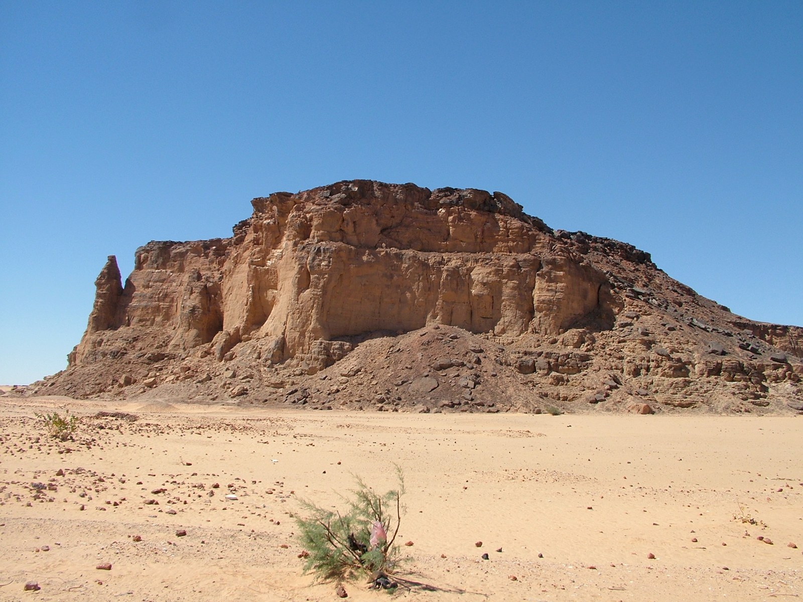
Jebel Barkal, photographed in 2005. A historical photograph of the mountain, not a reconstruction of ancient river channels or a record of present conditions. Photograph: LassiHU. Source · CC BY-SA 4.0. Resized and recompressed without cropping or colour changes.

The temples and pyramids around Jebel Barkal make power visible. The ground beneath them holds a quieter record: the work of water, sand and silt over thousands of years. Reading those layers changes the question we ask about Napata. Alongside who ruled here, and which gods they honoured, we can ask what made this particular place suitable for people to keep returning, building and living.
A 2026 study by Jan Peeters and eight coauthors reconstructs the Nile landscape near Jebel Barkal, beside present-day Karima in northern Sudan, over roughly 12,500 years. Its central finding is a productive tension. A river that had once cut down into its valley later helped build up a relatively stable floodplain. That setting supported the possibilities of settlement without dictating the history of Kush.1
Looking below the monuments
An ancient city does not survive through palaces alone. People need food, water and routes between places; buildings need land on which to stand. Yet a modern view of the Nile cannot simply be projected backwards. A field may conceal an old channel, and a seemingly natural rise may combine sediment brought by water with the debris of human occupation.
Peeters and his colleagues examined 26 sediment cores along two lines across the landscape. One crossed the valley; the other concentrated on the East Mound settlement area. They combined the sediment record with optically stimulated luminescence dating, radiocarbon dates and pottery evidence. These methods address different parts of the problem: what was deposited, approximately when, and how the layers relate to human activity.1
The result is a history of a place rather than a picture of an unchanging river. This matters because the broad statement that Nubian communities lived beside the Nile can hide considerable differences between one stretch of the valley and another. Water moving through a narrow corridor behaves differently from water spreading among several channels across a broad plain.
Earlier research in the Northern Dongola Reach, in the hinterland of Kerma, had already shown why local conditions matter. Mark Macklin and colleagues linked the histories of river channels and settlement, finding that the same broad climatic pressure could present different opportunities and dangers as the local river environment changed. Their study concerns a different area and chronology; it supplies a warning against treating the entire Nile as one uniform setting.2
The land the river left behind
Near Jebel Barkal, the new reconstruction identifies an earlier phase when the Nile eroded its valley, followed by extensive accumulation of floodplain sediment beginning around 4,000 years ago. In the later period, the channel belt remained comparatively stable. The authors connect this behaviour to the confined valley and the influence of the Fourth Cataract upstream.1
Stable here is a comparison across long spans of time, not a promise that every flood was harmless or every harvest secure. A river can maintain a broadly similar position while its floods, banks and sediment supply vary. Nor does the formation of fertile ground mean that this ground cultivated itself. Turning a floodplain into a lived landscape required work and decisions that geology alone cannot recover.
The distinction also guards against a seductive reconstruction: a Nile channel flowing immediately beside the Kushite temples simply because ancient river deposits occur nearby. The archaeological project’s explanation of the findings places an earlier channel close to the mountain roughly 10,000 years ago, long before the Kushite city. The age of a channel matters as much as its location.3
That is an important discipline in reading archaeology. Two features can share a map without sharing a historical moment. A river course, a settlement and a temple must each be dated before they can be assembled into the same scene.
A place chosen and remade
Napata also belonged to a wider cultural landscape. UNESCO’s World Heritage property combines Jebel Barkal with El-Kurru, Nuri, Sanam and Zuma, preserving temples, palaces, settlements and funerary monuments across more than 60 kilometres of the valley. The sacred importance of the mountain and the political institutions built around it cannot be reduced to the availability of agricultural soil.4
The site’s history makes that especially clear. The Jebel Barkal Archaeological Project records continued royal building and temple renovation during the Meroitic period, after the principal location of royal burials had shifted to Meroe. A change in the geography of kingship did not empty Barkal of meaning. Its importance could be renewed through religious practice, construction and memory.5
The sediment study helps explain the material setting within which such choices were possible. It does not replace those choices with a formula. Fertile land does not tell us why one institution commanded loyalty, why a ruler invested in a temple, or how the demands of a court were met. Those questions need inscriptions, excavated households, objects and comparisons across sites alongside the environmental record.
This is also why the movement of political power towards Meroe should resist a single climatic explanation. The study discusses environmental pressures but explicitly recognizes that relatively gradual environmental change cannot explain every abrupt transformation in urban history. Political and cultural processes retain their own importance.1
Endurance without inevitability
To ask why Napata endured is therefore to ask about a relationship. The river helped make a durable setting; communities and institutions made that setting into a centre of Kushite life. Neither side of the relationship is dispensable.
For readers of Sudanese history, the gain is substantial. The landscape becomes part of the evidence, rather than a desert backdrop behind royal monuments. Attention shifts towards the ground that supported everyday life and the knowledge needed to inhabit it. At the same time, the people of Kush remain historical actors, capable of choosing, adapting and investing meaning in a place.
An ancient floodplain is not a ready-made answer to present water policy. Its value here is historical: it shows how patient investigation beneath the surface can expand what we know about a Sudanese centre whose monuments have long drawn the eye. Napata’s endurance becomes more intelligible when we look beyond stone, without asking the river to explain everything.
Related Kandaka reading
Karanog and Dongola’s Throne Hall explores different periods and sites through material culture and architecture.
References
Jan Peeters, Timotheus G. Winkels, Pawel Wolf, Tim B. B. Skuldbøl, Elizabeth L. Chamberlain, Saskia Büchner-Matthews, Sami M. Elamin, El-Hassan A. Mohamed and Geoff Emberling (2026), “Holocene Nile dynamics shaped the physical and cultural landscape of ancient Nubia,” PNAS 123(18), e2529986123, especially pp. 2, 6–8. DOI. Public author full text. Published under CC BY 4.0; this article offers an original explanation and interpretation, not a translation of the paper. ↩︎ ↩︎ ↩︎ ↩︎
Mark G. Macklin and colleagues (2013), “Reach-scale river dynamics moderate the impact of rapid Holocene climate change on floodwater farming in the desert Nile,” Geology 41(6), 695–698. DOI. Context used here is confined to the published abstract. ↩︎
Rebecca Bradshaw, Jebel Barkal Archaeological Project (21 May 2026), “The Nile story keeps flowing: our research reaches new audiences”. ↩︎
UNESCO World Heritage Centre, “Gebel Barkal and the Sites of the Napatan Region”, description and statement of Outstanding Universal Value. ↩︎
Jebel Barkal Archaeological Project, “Historical Summary”. ↩︎